
Drone Flight Range Explained: Factors That Limit Distance & Battery Life
Share
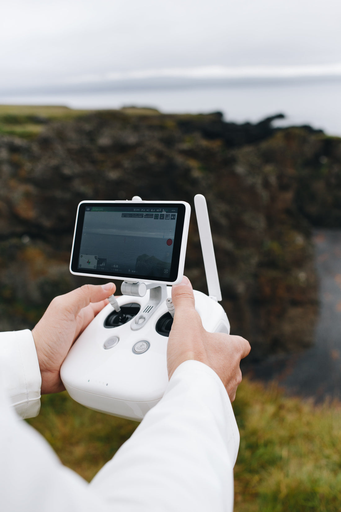
1. 🛫 How Far Can a Drone Actually Fly?
Drones have unlocked new possibilities for aerial photography, surveying, mapping, inspections, and recreational flight. But one of the most common and important questions among both beginners and professionals is: “How far can my drone actually fly?”
The answer isn't as simple as quoting a spec sheet — several dynamic factors influence real-world flight range and performance.
🚁 Why Flight Range Matters for Drone Users
Flight range determines how far your drone can travel from its controller or base station while maintaining a reliable connection and enough battery power to return safely. Whether you're filming wide landscapes, inspecting infrastructure, or surveying farmland, knowing your range limits is critical for safety, productivity, and legal compliance.
A longer range gives you more creative freedom and operational flexibility — but it also comes with responsibilities like monitoring signal strength, battery drain, and line-of-sight regulations.
🧮 Consumer vs. Commercial Drone Range Expectations
Flight ranges vary dramatically depending on the drone class and technology used:
|
Drone Type |
Typical Range |
Use Case |
|
Toy/Beginner Drones |
50–300 meters |
Indoor flight, backyard fun |
|
Mid-Range Consumer |
1–4 kilometers |
Casual videography, hobby flying |
|
Professional Drones |
4–15 kilometers |
Aerial filming, agriculture, SAR |
|
Industrial/Military |
20+ kilometers |
Surveillance, mapping, logistics |
Manufacturers often list maximum theoretical ranges under ideal, unobstructed conditions. In practice, real-world performance can be 20–50% lower due to environmental interference and battery constraints.
⏱️ Flight Time vs. Distance: A Crucial Difference
It's essential to distinguish maximum flight time from maximum flight distance.
A drone with a 30-minute battery life won’t cover 10 km and back unless:
- It’s flying in straight-line conditions
- There's minimal wind resistance
- It conserves battery for the return trip
So, when planning long-range missions, always factor in battery life, wind conditions, and Return-to-Home (RTH) buffer zones. A drone can technically reach far-off points, but if it can't return safely, you risk losing both the drone and your footage.
2. 📡 Signal Strength & Transmission Technology
Even the most powerful drone can only fly as far as its signal transmission system allows. Signal strength is one of the most underestimated—but most crucial—factors in determining drone flight range. A weak or lost signal mid-flight can trigger failsafes like Return-to-Home or worse, result in a crash or flyaway.
📶 Radio Frequency Basics: 2.4GHz vs 5.8GHz
Drones typically use either 2.4GHz or 5.8GHz frequencies—sometimes both—for communication between the remote controller and the aircraft.
- 2.4GHz:
- Longer range
- Better at penetrating obstacles (trees, walls)
- More prone to interference (used by Wi-Fi routers, baby monitors, etc.)
- 5.8GHz:
- Shorter range but faster data transfer
- Less congested frequency
- Works best in open environments with direct line of sight
Dual-band drones automatically switch between the two for optimal performance, but understanding their limitations helps you plan safer, longer flights.
🏙️ Line of Sight and Signal Interference Explained
Signal strength drops drastically when obstacles block the direct path between your drone and controller. These are known as non-line-of-sight (NLOS) situations.
Common signal disruptors:
- Buildings and walls (especially concrete or metal)
- Dense trees or forested areas
- Power lines, cell towers, and electrical interference
- Flying behind hills or below ridgelines
Even atmospheric conditions—like fog, high humidity, or electromagnetic activity—can weaken signal stability.
Tip: Always try to fly with a clear visual and signal line-of-sight (VLOS), especially in urban areas or challenging environments.
📲 Wi-Fi vs. OcuSync vs. Lightbridge: What’s the Difference?
Not all drone signal technologies are created equal. Here's how the most common systems compare:
|
Transmission Tech |
Range |
Latency |
Stability |
Used By |
|
Wi-Fi |
300–800m |
High |
Low |
Toy & budget drones |
|
Lightbridge |
~5 km |
Medium |
Medium |
Older DJI pro drones |
|
OcuSync (2.0/3.0) |
8–15 km |
Low |
High |
DJI Air, Mavic, Mini, Inspire |
- Wi-Fi Control: Simple, cost-effective, but suffers from interference and short range.
- DJI Lightbridge: Once a top-tier system, now phased out in favor of OcuSync.
- OcuSync: Industry-leading for long-range, low-latency, HD video feed—ideal for professionals.
Pro Tip: If you're serious about long-range, choose a drone with OcuSync 2.0 or 3.0, which uses robust frequency hopping and auto-switching for unmatched stability.
3. 🔋 Battery Life: The Ultimate Range Limiter
No matter how advanced your drone’s signal system is, battery life is the real cap on how far—and how long—you can fly. A drone that loses power mid-air becomes an expensive paperweight falling from the sky. Understanding the battery’s role in flight range is essential for maximizing both distance and safety.
🔋 Drone Battery Types: LiPo vs. Li-ion
Most drones use one of two battery technologies:
|
Battery Type |
Pros |
Cons |
Typical Use |
|
LiPo (Lithium Polymer) |
Lightweight, high discharge rate (C-rating), fast response |
Shorter lifespan, prone to swelling if mishandled |
Performance drones, racing, prosumer models |
|
Li-ion (Lithium-Ion) |
Higher energy density, longer cycle life |
Heavier, lower discharge rate |
Long-range drones, endurance-focused builds |
- LiPo batteries offer quick bursts of power and are preferred for agility and flight performance.
- Li-ion batteries excel in endurance, giving longer flight times for mapping, surveillance, and inspection tasks.
🔋 How Voltage, Capacity (mAh), and C-Rate Affect Flight Time
Drone battery performance isn’t just about size—it’s about how the battery delivers energy over time.
- Voltage (V): Affects the motor’s speed and thrust; higher voltage = more power.
- Capacity (mAh): Determines how long the battery can run; higher mAh = longer flight.
-
C-Rate: Measures how fast the battery can safely discharge.
For example, a 5000mAh 20C battery can safely deliver 100A (5A × 20).
Formula to Estimate Flight Time:
Flight Time (min)=Battery Capacity (mAh)Average Current Draw (mA)×60\text{Flight Time (min)} = \frac{\text{Battery Capacity (mAh)}}{\text{Average Current Draw (mA)}} \times 60Flight Time (min)=Average Current Draw (mA)Battery Capacity (mAh)×60
🔧 Example: A 5200mAh battery with a 13000mA average draw = ~24 minutes of flight.
🌡️ Cold Weather, Overheating & Other Battery Drainers
Battery efficiency is heavily influenced by environmental conditions and drone usage habits:
- Cold Weather: Reduces chemical activity and causes voltage drops; drones may auto-land early.
- High Temperatures: Can overheat cells, causing premature shutdown or permanent damage.
- Aggressive Flying: High throttle, fast ascent/descent, and windy conditions increase power draw.
- Payload Weight: Cameras, gimbals, and sensors add strain on the motors, drawing more current.
🧊 Pro Tip: In winter, pre-warm your batteries using a hand warmer or inside pocket before flying.
4. 🌬️ Environmental Factors That Cut Your Range
Even if your drone has a strong signal and a fully charged battery, the environment around you can severely limit your actual flight distance. From wind resistance to electromagnetic interference, several natural and man-made elements can cut your range short without warning.
💨 Wind Speed, Air Density, and Elevation Effects
Wind is one of the most immediate threats to range and flight efficiency.
- Headwinds force the drone to burn more power to maintain speed and stability.
- Tailwinds may extend range outbound but drain battery faster on return trips.
- Crosswinds destabilize the drone, triggering power-hungry stabilization systems.
Air density drops at higher altitudes, reducing propeller efficiency. The drone must spin faster to generate lift, which drains the battery faster.
Example: Flying at 2,000 meters above sea level may reduce your flight time by 10–20%, even in calm weather.
🌆 Urban Obstacles: Buildings, Trees, and Metal Structures
Drones struggle most in urban environments, where signals bounce, reflect, and are absorbed by physical structures.
- Tall buildings block GPS and RC signals, causing latency or disconnects.
- Trees and vegetation, especially when wet, absorb RF signals.
- Bridges, towers, and cranes can create signal dead zones and sudden interference.
These elements not only reduce range but increase the chance of loss of control or GPS drift.
⚡ Magnetic Interference from Power Lines & Cell Towers
High-voltage areas and strong electromagnetic fields can wreak havoc on your drone’s internal sensors:
- Compass errors may trigger erratic flight or force a Return-to-Home.
- IMUs (Inertial Measurement Units) may misread motion and orientation.
- FPV video feed can lag, freeze, or disconnect entirely.
📡 Tip: Always calibrate your compass away from power lines, large metal objects, and concrete with rebar before takeoff.
✅ Quick Tips to Overcome Environmental Limitations
|
Condition |
Impact |
Solution |
|
High Winds |
Shorter battery life |
Use Sport Mode cautiously; fly low |
|
High Altitudes |
Reduced lift |
Plan shorter, more frequent flights |
|
Urban Obstacles |
Signal loss |
Maintain LOS; avoid dense zones |
|
Cold Weather |
Battery voltage drops |
Pre-warm batteries; shorten missions |
5. ⚙️ Drone Hardware and Payload Considerations
Not all drones are built the same—hardware design, build quality, and the weight of attached components play a major role in determining how far and how long your drone can fly. Even small upgrades or payload changes can drastically alter performance.
🪶 Heavier Drones vs. Lightweight Flyers
A drone’s total weight—including its battery, motors, frame, and accessories—directly impacts how hard the motors must work to keep it airborne.
- Lightweight drones (like DJI Mini series) consume less power per minute and tend to offer longer flight times in calm conditions.
- Heavier drones (like Inspire 2 or industrial quadcopters) are powerful but require more thrust and battery output, reducing overall range.
Trade-off: Heavier builds often include better cameras and sensors but need larger, faster-draining batteries.
🎥 Impact of Gimbals, Cameras, and Sensors on Range
Any payload added to the drone—especially stabilizers and high-resolution cameras—adds weight and energy demands.
- 3-axis gimbals constantly draw power for stabilization.
- Thermal, multispectral, or LiDAR sensors increase current draw.
- Dual-camera systems can shave several minutes off flight time.
🧮 Example: A mapping drone with a heavy RTK camera and gimbal may lose 3–5 minutes of range compared to flying without those attachments.
🔄 Propeller Efficiency & Motor Power Output
The propeller and motor combination can make or break your drone’s flight endurance:
- High-efficiency propellers produce more lift with less energy, ideal for distance flying.
- High-speed motors offer power for racing or wind resistance but at the cost of battery life.
- Brushless motors are now standard for quality drones, offering better energy-to-thrust ratios and lower maintenance.
Upgrading to larger, lighter carbon-fiber propellers (if compatible) can boost both stability and flight time—especially in long-distance or high-altitude operations.
🧰 Hardware Optimization Tips for Better Range
|
Hardware Area |
Optimization Tip |
|
Frame Material |
Use lightweight carbon fiber or composites |
|
Propellers |
Upgrade to high-efficiency, low-noise props |
|
Motors |
Choose brushless, low-KV motors for endurance |
|
Payload |
Remove unnecessary accessories during long flights |
|
Gimbal |
Balance before flight to reduce power load |
By tuning your drone’s hardware setup and minimizing payload where possible, you can squeeze out extra minutes—and meters—on every mission.
6. 🧭 Geofencing, Altitude Limits, and No-Fly Zones
Even with strong signals, full batteries, and efficient hardware, your drone may still hit invisible barriers—digital boundaries imposed by manufacturers, governments, and flight regulations. Understanding these virtual limits is essential to avoid mid-flight restrictions, forced landings, or legal consequences.
🚧 How Flight Software Limits Range (Geo & Altitude Fences)
Most modern drones—especially DJI and Autel models—use geofencing technology built into their flight software. These virtual fences define where and how high a drone can fly:
- Geo Zones: Prevent takeoff or auto-land your drone when it enters restricted airspace.
- Altitude Limits: Cap how high the drone can ascend—usually between 120m and 500m depending on regional laws.
- Distance Limits: Many apps allow users to set a max distance to prevent flyaways or out-of-sight flying.
📲 Example: DJI drones use FlySafe zones, color-coded into Restricted, Authorization, and Warning zones, which can be overridden only with proper clearance.
🛑 Government-Imposed Distance/Height Regulations
Every country has its own drone regulations—but most follow international best practices like those from EASA (Europe), FAA (USA), or CAA (UK). These typically include:
- Visual Line of Sight (VLOS): You must always be able to see your drone.
- Maximum Altitude: Generally capped at 120 meters (400 feet) above ground.
- Flight Distance: Restricted around airports, military areas, national parks, and populated zones.
Pakistan Example 🇵🇰:
Pakistan’s Civil Aviation Authority (CAA) requires permission for drones over 250g, and strictly limits flying near airports, military installations, or government buildings.
📌 Pro Tip: Always check local airspace maps and regulations before planning a long-range mission.
⚖️ Legal Risks of Pushing Beyond Visual Line of Sight (BVLOS)
Flying beyond VLOS without clearance is illegal in many countries and can result in:
- Fines or license suspension
- Drone confiscation
- Potential legal action if your drone causes damage or breaches privacy
Even in countries where BVLOS flights are allowed, they typically require:
- Remote ID systems
- Licensed drone pilots
- Real-time telemetry and emergency override systems
🛡️ Remember: Breaking these rules—even unintentionally—can get your drone grounded permanently.
✅ Summary: Digital Limits vs. Physical Range
|
Limiter Type |
Effect on Range |
How to Manage |
|
Geofencing |
Auto-restricts takeoff/flying |
Unlock zones with permission |
|
Altitude Caps |
Limits vertical flight |
Customize within legal limits |
|
No-Fly Zones |
Hard stops near sensitive areas |
Use airspace apps (e.g., AirMap, Aloft) |
|
VLOS Laws |
Restricts long-distance |
Fly with spotters or request BVLOS license |
7. 🧠 Smart Features That Extend or Kill Range
Modern drones come packed with intelligent features designed to make flying safer and more user-friendly. But here’s the catch: some of these features help extend your range, while others can quietly reduce it in the name of safety or automation. Knowing how they work allows you to take control of your drone’s full potential—without risking a crash or flyaway.
🏠 Return-to-Home (RTH) Settings & Auto Cut-Offs
The Return-to-Home (RTH) function is a lifesaver—but if not configured correctly, it can end your mission early.
- Low Battery RTH: Automatically returns the drone when battery hits a threshold (typically 20–30%). If you’re far out, it may trigger earlier than expected.
- Signal Loss RTH: If the drone loses connection for a few seconds, it will auto-return—often prematurely in congested areas.
- Smart RTH: Allows the pilot to manually initiate return with a single button if unsure about range or obstacles.
🔧 Pro Tip: Adjust the RTH altitude high enough to avoid buildings or trees—but not too high to waste energy during the return.
🧱 Obstacle Avoidance Systems vs. Battery Conservation
Collision avoidance tech is useful but power-hungry:
- Uses multiple visual, infrared, or ultrasonic sensors
- Constantly processes terrain data to avoid crashes
- Activates flight corrections that may use more motor power
If flying in open, obstacle-free areas, consider switching to Sport Mode or disabling Obstacle Avoidance (if legally and safely allowed) to conserve energy and increase range.
🚁 Flight Mode Settings (Sport, Normal, Tripod)
Your drone’s flight mode directly influences range, speed, and power consumption:
|
Mode |
Features |
Effect on Range |
|
Sport Mode |
Max speed, no obstacle sensing |
More distance in less time, but drains battery fast |
|
Normal Mode |
Balanced, includes sensors |
Good for stable long-range flights |
|
Tripod/Cinematic Mode |
Slower movement, precision control |
Shorter distance but smoother video |
For long-range flights, Normal Mode is your best bet—it balances energy use, camera control, and signal stability.
🧠 Bonus: Advanced Features That Can Extend Range
- Dynamic Home Point: Updates your RTH location as you move with the controller—great for mobile operators.
- Waypoint Missions: Predefined flight paths optimize battery usage and minimize unnecessary movements.
- Signal Boosters: Some controllers and apps allow for external antennae or boosters to improve transmission distance.
✅ Smart Feature Settings Checklist
|
Feature |
Setting |
Recommendation |
|
RTH Altitude |
30–50m above tallest obstacle |
✅ Check before every flight |
|
Obstacle Avoidance |
Off in open areas, On in urban flights |
⚙️ Adjust per environment |
|
Flight Mode |
Normal for range, Sport for wind |
🔁 Switch mid-flight if needed |
|
Battery Warning |
Set custom threshold (25–30%) |
⛑️ Leave buffer for return |
8. 📊 Real-World Drone Range Comparisons
While manufacturers often promote impressive maximum ranges—some boasting 15 km or more—these numbers are usually achieved in ideal conditions: no wind, perfect line-of-sight, and minimal interference. In reality, real-world performance often falls short, but that doesn’t mean your drone isn’t capable—just that you need to plan smarter.
🔍 DJI, Autel, Skydio: Top Models and Their Max Distances
|
Drone Model |
Max Stated Range |
Real-World Usable Range |
Signal System |
|
DJI Mini 4 Pro |
20 km |
6–10 km |
OcuSync 4.0 |
|
DJI Mavic 3 Pro |
15 km |
8–12 km |
OcuSync 3.0 |
|
DJI Air 3 |
20 km |
7–11 km |
OcuSync 4.0 |
|
Autel Evo II Pro V3 |
15 km |
6–9 km |
Autel Skylink 2.0 |
|
Skydio 2+ |
6 km |
2–3.5 km |
Skydio Beacon + Wi-Fi |
|
Parrot Anafi USA |
5 km |
2.5–3.5 km |
Encrypted Wi-Fi |
|
FPV/Racing Drones |
Varies |
1–3 km |
Analog or Digital (HDZero, DJI FPV System) |
📝 Note: “Real-world usable range” includes return-trip planning and variable conditions such as wind, obstacles, and interference.
🏙️ Range Benchmarks: Testing in Urban vs. Rural Zones
Environment has a major effect on drone communication:
|
Environment |
Typical Signal Loss Factors |
Average Range Reduction |
|
Urban |
Wi-Fi congestion, buildings, magnetic interference |
40–60% |
|
Suburban |
Light interference, some obstacles |
20–30% |
|
Rural/Open Field |
Minimal interference, wide visibility |
0–10% |
|
Forests/Hills |
Visual + RF blockage, altitude shifts |
30–50% |
🔭 Example: A DJI Mavic 3 that boasts a 15 km range might only reach 5–7 km in a dense city before losing signal or auto-triggering Return-to-Home.
📈 Chart: Advertised Range vs. Average Usable Range
Here's a simplified comparison:
lua
CopyEdit
| Drone Model | Advertised Max | Usable (Urban) | Usable (Rural) ||------------------|----------------|----------------|----------------|| DJI Mini 4 Pro | 20 km | 6 km | 10–12 km || DJI Air 3 | 20 km | 7 km | 11 km || Autel Evo II V3 | 15 km | 5 km | 9 km || Skydio 2+ | 6 km | 2.5 km | 3.5 km |📍 Takeaway: Always plan your flight based on the shorter of the two numbers—not the manufacturer’s max.
9. 🛠️ Tips to Maximize Your Drone’s Flight Range
Whether you're capturing cinematic footage or surveying large areas, extending your drone’s flight range safely can make or break your mission. These expert-backed tips help you fly farther—without pushing your drone or breaking regulations.
✅ Best Pre-Flight Practices for Long-Distance Missions
- Fully Charge All Batteries – Drone, controller, phone/tablet—everything.
- Update Firmware & Maps – Bugs, outdated NFZs, or software glitches can limit range.
- Calibrate Compass & IMU – Especially if flying in a new or high-interference zone.
- Plan Your Route – Use apps like Litchi or DJI Waypoints for optimized energy use.
- Check Weather & Wind Conditions – Avoid strong headwinds and flying in high heat or cold.
📡 Antenna Positioning Hacks & Signal Boosters
Most signal issues stem from poor antenna orientation. Remember:
Flat face of the antenna points toward the drone, not the tip.
Tips:
- Keep the controller at chest height, angled slightly upward.
- Use Yagi antennas or parabolic signal boosters for up to 20–30% signal improvement.
- Avoid turning your body between the drone and the controller—especially with Wi-Fi-based models.
🔋 Battery Maintenance Tips for Longer Life
Good batteries = longer flights. Follow these simple habits:
|
Tip |
Why It Matters |
|
Don’t fly below 20% battery |
Deep discharges reduce battery lifespan |
|
Store at 50–60% charge |
Preserves battery health during non-use |
|
Avoid charging immediately after landing |
Heat buildup can damage cells |
|
Use a balance charger (if LiPo) |
Ensures safe and equal cell charging |
🧊 Winter Tip: Pre-warm batteries to 20–25°C before flight using your hands, pockets, or a battery warmer
🛩️ Optimize Flight Style and Drone Settings
- Use smooth throttle control to reduce power spikes.
- Fly higher in rural areas for better signal, but lower in windy or obstacle-heavy zones.
- Switch to Normal or Cruise mode for better energy efficiency.
- Reduce payload weight—remove lens hoods, ND filters, or unnecessary accessories.
🧠 Bonus: Use Mission Planning Software
Apps like Litchi, Pix4Dcapture, and DJI Fly Waypoints let you:
- Automate flight paths for efficient energy use
- Monitor battery consumption live
- Set fail-safes and return paths based on real-time telemetry
✈️ Summary: The Range-Boosting Flight Checklist
|
Task |
Boosts |
Time |
|
Calibrate compass/IMU |
Signal stability |
1–2 min |
|
Check battery health |
Flight duration |
1 min |
|
Angle antennas correctly |
Signal strength |
Instant |
|
Use lightweight settings |
Power efficiency |
Ongoing |
|
Plan waypoints |
Route optimization |
5–10 min |
10. ❓Conclusion & FAQs
Flying long-range isn't just about what your drone can do—it’s about how well you understand and manage its limitations. From signal interference and battery health to legal boundaries and smart features, your drone's effective flight range is shaped by multiple overlapping factors.
By optimizing each part—from pre-flight setup to in-flight techniques—you can safely fly farther, longer, and more confidently, whether you're a hobbyist, content creator, or commercial pilot.
📌 Key Takeaways:
- Signal technology and antenna orientation are just as important as battery size.
- Battery drain is affected by payload, flight style, and even the weather.
- Geofencing and regulations can halt a flight even when conditions are perfect.
- Use flight planning tools and smart modes to maximize energy use and signal integrity.
- Always leave enough power for a safe return—range means nothing if you can't come back.
🙋 Frequently Asked Questions (FAQs)
Q1: Can I remove geofencing restrictions to fly farther?
🛑 Answer: In most cases, geofencing can only be overridden with official authorization from the drone manufacturer and local aviation authority. Bypassing it illegally can lead to heavy fines or drone confiscation.
Q2: Why is my drone losing signal at just 1 km?
📡 Answer: Signal loss at short distances often points to:
- Poor antenna orientation
- Urban interference (Wi-Fi congestion)
- Flying behind buildings, hills, or trees
- Outdated firmware or app glitches
Q3: How can I tell if cold weather is affecting my range?
🌡️ Answer: Look for signs like:
- Faster battery drop
- Early Return-to-Home triggers
- Power warnings even with a charged battery
Warm up your batteries and shorten missions in freezing temps
Q4: Do propeller upgrades really make a difference in range?
⚙️ Answer: Yes. High-efficiency, well-balanced propellers reduce strain on motors and can extend flight time by 2–5 minutes, especially when paired with lightweight payloads.
Q5: What’s the best drone for long-range flying in 2025?
🚁 Answer: Top picks include:
- DJI Air 3 (best overall balance of range, price, and features)
- Autel Evo II Pro V3 (great for professionals with solid distance + camera)
- DJI Mini 4 Pro (sub-250g, surprisingly powerful OcuSync 4.0 system)