
How Drones Are Changing Agriculture: Precision Farming Explained
Share
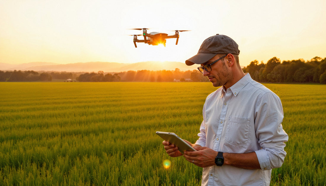
1. The Agricultural Revolution in the Sky
From Manual Labor to Aerial Intelligence
For centuries, agriculture has relied on the hands and eyes of farmers. Field inspections, seasonal guesswork, and manual labor were the norm. But today, a quiet revolution is unfolding above the fields—drones are taking flight, transforming how we grow, monitor, and manage crops. With high-resolution cameras and advanced sensors, drones can scan entire farmlands in minutes, offering real-time insights that once took days to gather.
What used to require teams of workers can now be handled by a single drone operator with a smartphone and the right software. This shift isn’t just about convenience—it’s about unlocking new levels of precision, efficiency, and sustainability in farming.
Why Precision Farming Is the Future of Food Security
As the global population grows and climate patterns shift, agriculture must produce more food with fewer resources. This is where precision farming—powered by drones and data—becomes essential. By applying water, fertilizer, and pesticides only where and when they're needed, precision agriculture reduces waste, lowers costs, and boosts yields.
Drones play a central role in this transformation. They enable farmers to see stress signs in crops before the human eye can detect them, to map soil variability with scientific accuracy, and to make data-driven decisions that maximize output without harming the environment.
2. What Is Precision Farming?
Definition and Core Principles
Precision farming—also known as precision agriculture—is a modern farming approach that uses technology to monitor and manage crops, livestock, and environmental conditions with pinpoint accuracy. Instead of treating an entire field the same way, farmers use data to treat specific areas differently based on need.
The core principle is simple: do the right thing, in the right place, at the right time. That means applying the exact amount of water, fertilizer, or pesticide only where and when it’s needed—maximizing efficiency and minimizing waste.
How It Differs from Traditional Farming Methods
In traditional farming, decisions are often made based on experience, assumptions, or field averages. For example, a farmer might fertilize an entire 100-acre field the same way, regardless of whether different sections have different soil conditions or crop health levels.
Precision farming flips that approach. It uses data from drones, sensors, satellites, and software to break a farm into micro-zones—each managed according to its unique needs. This results in smarter use of resources, improved yields, and lower environmental impact.
|
Traditional Farming |
Precision Farming |
|
Uniform treatment across entire field |
Zone-specific and need-based treatment |
|
Relies on observation and experience |
Relies on real-time data and analysis |
|
Higher risk of overuse/underuse of inputs |
Optimized use of inputs for better ROI |
The Role of Data in Modern Agriculture
At the heart of precision farming is data—collected from various sources like drones, satellite imagery, soil sensors, and weather stations. This data feeds into farm management systems powered by AI and machine learning, helping farmers make informed decisions about planting, irrigation, pest control, and harvesting.
Drones are one of the most valuable data collection tools because they can provide high-resolution imagery, detect crop stress early, and map large areas quickly. Combined with analytics, this data gives farmers a powerful edge in producing more with less.
3. How Drones Fit into Precision Agriculture
Types of Agricultural Drones: Fixed-Wing vs. Multirotor
Agricultural drones come in two primary forms, each suited to different farming needs:
· 🛩️ Fixed-Wing Drones
These resemble miniature airplanes. They are built for long flight times and large area coverage, making them ideal for mapping vast fields in a single flight. Fixed-wing drones are commonly used for surveying, topographic mapping, and crop health analysis on large farms.
· 🚁 Multirotor Drones
These are the most common type of drone seen on farms. With vertical takeoff and landing (VTOL) capability, multirotors are perfect for close-up inspections, spot spraying, and detailed imaging. They offer better maneuverability but have shorter flight durations compared to fixed-wing models.
|
Feature |
Fixed-Wing |
Multirotor |
|
Flight Time |
Longer (45–90 min) |
Shorter (20–30 min) |
|
Area Coverage |
Large-scale (100+ hectares) |
Small to medium plots |
|
Use Cases |
Surveying, mapping |
Spot spraying, crop inspection |
|
Cost |
Higher upfront |
More affordable |
Payloads and Sensors: Multispectral, Thermal, RGB, LiDAR
The true power of a drone lies in its payload—the sensors or cameras it carries. Here's what they can do:
· 📷 RGB Cameras (Standard Visual Imaging)
Capture high-resolution images of crops for visual inspection, weed mapping, and field progress documentation.
· 🌈 Multispectral Sensors
Detect light beyond the visible spectrum (e.g., near-infrared), which helps assess plant health using vegetation indices like NDVI (Normalized Difference Vegetation Index).
· 🔥 Thermal Cameras
Measure temperature variations across fields. Useful for identifying water stress, irrigation leaks, or disease outbreaks.
· 🌍 LiDAR (Light Detection and Ranging)
Uses laser pulses to create precise 3D maps of terrain and crop canopy. Ideal for topography mapping, drainage planning, and biomass estimation.
Real-Time Data Collection and Cloud-Based Processing
Modern agri-drones don’t just collect data—they stream, store, and analyze it in real time:
· Edge Computing Onboard: Some advanced drones process data mid-flight, providing instant insights on crop health or anomalies.
· Cloud Platforms: Data is uploaded to platforms like DroneDeploy, Pix4Dfields, or Sentera where it’s transformed into actionable maps and reports.
· Seamless Integration: These platforms integrate with Farm Management Systems (FMS) and Geographic Information Systems (GIS), enabling precise application of resources via tractors, irrigation systems, or robotic sprayers.
This combination of hardware and software makes drones not just flying cameras, but mobile data hubs—enabling farmers to take action faster and smarter than ever before.
4. Key Use Cases of Drones in Farming
Drones are more than just flying cameras—they're versatile tools that serve multiple functions across every stage of the agricultural cycle. Below are the most impactful use cases where drones are transforming farm operations.
🌱 Crop Health Monitoring and Disease Detection
Drones equipped with multispectral and thermal sensors can detect crop stress, pest infestation, and fungal diseases before they’re visible to the naked eye. By analyzing vegetation indices like NDVI or NDRE, farmers can:
- Identify unhealthy areas of the field
- Take targeted action (pesticides, irrigation, etc.)
- Prevent yield loss through early intervention
This proactive approach is far more efficient than traditional scouting methods.
🧪 Soil and Field Analysis for Smart Planting
Before the first seed is planted, drones can be used for:
- Topographic Mapping: Understanding slope, elevation, and drainage patterns
- Soil Texture Analysis: Evaluating moisture content, erosion risks, and variability
- Field Zoning: Dividing land into management zones for variable-rate input application
This helps create data-driven planting strategies that boost productivity from the start.
🌾 Variable Rate Application: Targeted Spraying & Seeding
With the help of RTK (Real-Time Kinematic) GPS and smart mapping software, drones can:
- Perform precise spraying of fertilizers or pesticides only where needed
- Execute variable rate seeding based on soil and crop data
- Reduce chemical use by up to 30%, saving money and protecting the environment
Spraying drones like the DJI Agras T40 are now capable of carrying 40+ liters per flight and covering hectares in minutes.
💧 Irrigation Mapping and Water Management
Using thermal imaging, drones can detect areas of water stress long before crops wilt. Farmers can:
- Monitor irrigation efficiency
- Detect leaks or clogged lines
- Improve water distribution patterns
This promotes sustainable water usage—especially crucial in drought-prone areas.
🐄 Livestock Monitoring from the Air
For livestock farmers, drones can be a time-saving solution to:
- Locate animals across large grazing areas
- Monitor herd movement and behavior
- Check for signs of distress or illness (especially with thermal imaging)
This reduces manual labor and improves overall herd health and safety.
5. Benefits of Drone-Based Precision Farming
Drones are rapidly proving to be one of the most valuable technologies in agriculture—not because they look futuristic, but because they deliver measurable benefits where it counts: cost, time, yield, and sustainability. Here’s how drone-based precision farming is revolutionizing agribusiness:
💰 Reduced Input Costs (Fertilizers, Pesticides, Labor)
Drones allow farmers to apply chemicals only where needed, rather than blanket-spraying entire fields. This reduces chemical usage by up to 30–50%, leading to:
- Lower input costs
- Less chemical runoff and environmental impact
- Reduced manual labor for crop monitoring and spraying
Over time, these savings can amount to thousands of dollars per growing season—especially for large-scale operations.
🌾 Increased Yield and Profit Margins
When crops get exactly what they need—no more, no less—they thrive. By enabling early detection of disease, pest outbreaks, or water stress, drones help:
- Boost crop health and productivity
- Prevent localized losses from spreading
- Improve harvest timing and field management decisions
Better crop health = higher yields = increased revenue. It’s that simple.
⏱️ Time Efficiency: Cover More Land, Faster
A drone can scan hundreds of acres in under an hour, a job that would take a team of field workers days to complete. Farmers can:
- Get same-day insights after a storm or pest outbreak
- Monitor crop stages weekly without stepping foot in the field
- Respond to problems instantly with actionable aerial maps
In short, drones put farmers in multiple places at once—from above
🌍 Environmentally Friendly and Sustainable Practices
Precision farming with drones supports eco-conscious agriculture by:
- Reducing over-application of fertilizers and pesticides
- Conserving water through optimized irrigation
- Minimizing carbon footprints from heavy machinery
This shift is crucial not only for complying with modern environmental regulations, but also for positioning farms as sustainable and future-ready.
📉 Reduced Risk and Human Error
Manual inspections and estimates often miss early warning signs or lead to overcorrections. Drone-generated data is:
- Objective and highly accurate
- Repeatable and comparable over time
- Instantly actionable when paired with AI-driven software
This means fewer guesswork decisions—and fewer costly mistakes.
Altogether, drone technology isn’t just a “nice-to-have” in modern farming—it’s a competitive advantage. Whether you're a smallholder or managing thousands of hectares, drones make it possible to grow smarter, not harder.
6. Tech Stack Behind the Scenes
Behind every successful drone-based precision farming operation is a powerful ecosystem of technologies. It's not just about flying a drone—it's about how the data is collected, processed, and turned into insights. This tech stack is what enables real-time, data-driven agriculture.
🤖 AI, Machine Learning, and Predictive Analytics
Once drone imagery is collected, it’s analyzed using artificial intelligence and machine learning algorithms that can:
- Classify crop types and health levels automatically
- Predict yield based on growth stage and plant density
- Detect anomalies (e.g., nutrient deficiencies, diseases, pest infestations)
Over time, these systems "learn" from past data, allowing farmers to move from reactive decisions to predictive farming.
For example, a platform might identify a trend of nitrogen deficiency in a specific field zone and recommend proactive fertilizer adjustments before the issue impacts yields.
📡 Integration with GPS, GIS, and IoT Systems
Precision farming requires accurate geolocation and seamless integration across devices and platforms:
- GPS (Global Positioning System): Enables geo-referenced maps and targeted actions like variable-rate spraying.
- GIS (Geographic Information Systems): Visualizes spatial data layers like soil types, field zones, and moisture levels.
- IoT Devices: Include soil moisture sensors, weather stations, and smart irrigation systems that sync with drone data.
When integrated, this tech trio provides a 360° view of the farm, allowing for hyper-local decision-making.
🧠 Popular Agri-Tech Platforms and Drone Software
Several platforms are transforming how drone data is managed and utilized. Here are some of the most widely used:
|
Platform |
Key Features |
|
DroneDeploy |
Real-time mapping, crop health analysis, 3D modeling |
|
Pix4Dfields |
Field-specific insights, zonal prescription maps, multispectral image processing |
|
DJI Terra |
Seamless integration with DJI drones, terrain follow, real-time 2D/3D reconstructions |
|
Sentera |
NDVI/NDRE analytics, plant count, weed detection |
|
Agremo |
AI-based crop analytics, stand counts, stress zones, yield predictions |
These platforms turn aerial imagery into field-ready intelligence—whether it's a pest outbreak alert or a prescription map for smart tractors.
🔄 Cloud-Based Storage and API Integration
Cloud computing plays a major role in scaling drone data:
- Store massive datasets securely and access from any device
- Sync across devices (laptops, tablets, smartphones) for field or office use
- Connect via APIs to other farm management systems, CRMs, or ERP software
This creates a data loop where insights flow seamlessly between machines, platforms, and people—enabling truly connected farms.
7. Cost vs. ROI: Are Drones Worth It for Farmers?
Investing in drone technology may seem like a high upfront cost for many farmers, especially smallholders—but the return on investment (ROI) often outweighs the initial expense when measured in increased efficiency, higher yields, and lower input costs.
📉 The Cost of Getting Started
The cost of drone-based farming depends on the level of sophistication you need:
- Entry-Level Multirotor Drone (RGB Only):
- $800–$2,000
- Best for basic crop scouting and field photography
- Advanced Multispectral/NDVI Drone:
- $3,000–$10,000
- Suitable for crop health monitoring and prescription mapping
- Spraying Drones (e.g., DJI Agras Series):
- $10,000–$25,000+
- Used for precision application of fertilizers or pesticides
- Software & Subscription Costs:
- $300–$2,000 annually
- Platforms like DroneDeploy, Pix4Dfields, or Agremo may charge per hectare or per analysis
Optional services like third-party drone consultants or data analysts can also add to initial costs but help ensure optimal usage.
📈 ROI Calculation Formula
Here’s a simple formula farmers use to estimate ROI:
ROI (%) = [(Gains from Drone Use – Total Costs) / Total Costs] × 100
Example:
- Yield increase: +10% (worth $12,000)
- Input savings: $4,000
- Drone system + software cost: $8,000
ROI = [($12,000 + $4,000 – $8,000) / $8,000] × 100 = 100%
In this case, the investment would pay for itself in just one season.
🧑🌾 Smallholder Farmers vs. Large-Scale Operations
- Smallholder Farms (Under 50 Acres)
- May benefit more from hiring drone service providers or co-owning a system through cooperatives
- Can still see ROI through reduced labor and targeted interventions
- Large-Scale Farms (500+ Acres)
- See the highest ROI from automation, scalability, and frequent drone use
- Can afford in-house drone pilots and data teams for real-time analysis
Many governments and agri-tech programs now offer subsidies or drone-as-a-service (DaaS) models to lower the entry barrier for small and mid-sized farmers.
💡 When Do Drones Pay Off?
Drones tend to deliver positive ROI when used for:
- Monitoring high-value crops (e.g., fruits, vegetables, specialty grains)
- Farms located in regions with limited labor availability
- Areas with variable soils, pest/disease risks, or irrigation issues
- Replacing inefficient manual scouting or spraying processes
In short, while the upfront investment may feel intimidating, drones quickly prove their value when integrated into a smart precision farming system. For many, the first successful season is all it takes to realize: drones aren’t a cost—they’re an asset.
8. Challenges and Limitations
While drones offer groundbreaking potential in agriculture, their adoption isn’t without hurdles. From technical barriers to legal red tape, farmers must navigate several challenges before fully benefiting from drone-powered precision farming.
⚖️ Regulatory Hurdles and Airspace Laws
Agricultural drones are subject to strict regulations in many countries. Common limitations include:
- Licensing requirements for commercial drone pilots
- Altitude and distance limits (e.g., max 400 ft above ground)
- Restricted zones near airports, military bases, or populated areas
- Flight permission protocols for spraying drones in certain regions
Example: In Pakistan and India, drone spraying often requires special approval from civil aviation authorities.
These rules can delay implementation and increase costs due to the need for training, insurance, or licensed operators.
🌦️ Weather Dependency and Operational Limits
Drones may be advanced, but they’re still at the mercy of nature:
- Can’t fly safely in strong winds, heavy rain, or extreme heat
- Battery life drops in colder temperatures
- Limited flight time (typically 20–40 minutes per charge)
This means operations must be carefully scheduled around weather forecasts—especially when timing is critical for spraying or data collection.
📊 Data Overload and the Skill Gap
Drone technology produces a massive volume of raw data, including:
- High-resolution imagery
- Multispectral maps
- Thermal readings
- Topographical 3D models
However, interpreting this data requires specialized knowledge. Many farmers:
- Struggle to read vegetation indices or prescription maps
- Lack time or training to act on data quickly
- Depend on third-party consultants or service providers
Without proper training or analytics tools, valuable insights may be left unused—defeating the purpose of precision farming
💸 High Upfront Costs for Some Users
Although drone prices are decreasing, the initial cost remains prohibitive for many small and medium-scale farmers—especially in developing countries. Additional costs include:
- Software subscriptions
- Sensor upgrades
- Maintenance and replacements
- Staff training or drone service fees
Cooperative ownership models and government subsidies are slowly bridging this gap—but adoption is still uneven globally.
🔌 Infrastructure Barriers in Remote Areas
In areas with limited internet, GPS, or power access:
- Cloud syncing becomes unreliable
- Firmware updates and real-time uploads are delayed
- Drone recovery and repairs become logistically difficult
This limits drone utility in exactly the regions where agricultural modernization is most needed.
Conclusion: Drones Are the Future of Smart Farming
From scanning fields in minutes to applying fertilizers with surgical precision, drones are no longer futuristic—they’re farming tools of today. Precision agriculture, once a concept reserved for tech-savvy agribusinesses, is now accessible to farmers worldwide thanks to drones and cloud-powered software.
Despite challenges such as cost, regulation, and data interpretation, the ROI potential is strong, especially for medium to large-scale farms. More importantly, drones help build a resilient, resource-efficient, and sustainable farming ecosystem—one that can meet rising food demands without exhausting the planet.
Whether you're a farmer looking to boost yields, an investor eyeing agri-tech, or a policymaker focused on food security, one thing is clear: the sky is no longer the limit—it’s the new farmland.
❓ FAQs: Precision Farming with Drones
🤔 Are drones legal for agricultural use everywhere?
Drone laws vary by country. Most require registration and a commercial pilot license for agricultural use. Always check with your local aviation authority before flying.
🚁 What type of drone should I buy for farming?
- For small farms: Multirotor drones with RGB/multispectral cameras are ideal.
- For large-scale farms: Fixed-wing drones or spraying drones like DJI Agras are better suited for efficiency and coverage.
💡 Do I need technical skills to use drones on my farm?
Basic drone operation is easy to learn, but interpreting data may require training or hiring an agri-tech specialist. Many software platforms simplify this with easy-to-read maps and alerts.
📈 How soon can I see ROI from a drone investment?
Many farmers report 100% ROI within one season, especially when using drones for spraying, yield optimization, and reducing chemical usage.
🌱 Can drones really improve yield?
Yes. By detecting early signs of disease, monitoring plant health, and guiding precise interventions, drones help prevent crop loss and increase per-acre productivity.
🌍 Are drones used in developing countries too?
Yes. Countries like India, Kenya, and Pakistan are rapidly adopting drone technology in agriculture, supported by government initiatives and agri-tech startups offering drone-as-a-service (DaaS).